Subscribe

Local leaders must plan for stronger, more frequent natural disasters

timestamp icon
category icon Editorials

It’s so easy to focus on what individuals can do to prevent and prepare for a disaster, that we often miss the bigger picture — what are our elected leaders doing to minimize the impact of disasters like flooding, wildfires and earthquakes on our communities?

As the executive director of the local American Red Cross chapter discussed in this week’s A1 story about an upcoming meeting on disaster prep, people can, on an individual level, do quite a bit to get ready for the next natural disaster. We can keep fully stocked disaster kits in our homes and cars; be ready to survive on our own for three weeks; check on our most vulnerable neighbors; and bolt our home’s foundation down and install a switch to automatically shut off natural gas in case that monster earthquake hits in our lifetime.

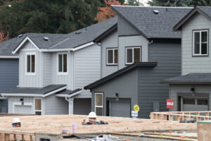
But what is happening on a larger level to ensure that our communities aren’t going to be wiped out by the next disaster? What are local and regional officials doing to ensure that our schools, roads, homes and infrastructure are being built in the safest areas?

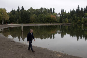
The answers often aren’t as clear as we would hope. There are tools that local planners can use to build around dangerous areas, such as the Federal Emergency Management Agency (FEMA) flood maps, which show areas most likely to experience flooding once every 100 or 500 years, but climate change is changing the game so rapidly, that some of these tools are no longer as reliable as they may have been 50 years ago — or even 10 years ago.

A 2016 National Public Radio report, for instance, found that FEMA flood maps aren’t accounting for climate change and could be considered “outdated” in as little as five years.

One engineer quoted in the story said she’d spent more than a decade drawing flood maps for FEMA and knew the maps were not taking into account changes in rainfall caused by climate change.

Local planners rely on those maps to figure out the best places for our communities’ growth — to site the new home developments where our families will live, the industrial complexes that might store toxic chemicals and the schools where our children will spend the majority of their daytime hours. What happens if we’re building in areas that used to see massive flooding once every 100 years, but will now see flooding once every 10 or 15 years?

The possibility of a devastating Cascadia earthquake captures headlines, but flooding may be the bigger concern, especially in the Camas-Washougal area. According to the county’s disaster prep research, “floods are the most common disaster in Washington State and in Clark County.”

The Clark Regional Emergency Services Agency (CRESA) warns that, as density increases and areas that once absorbed rainfall are replaced with roads, parking lots and developments, “the volume of stormwater runoff and the area over which it floods will increase. As a result, unknown numbers of homes that were once outside mapped floodplains will face an increased threat of flooding, a threat they were never built to withstand.”

Although unheard of just 20 years ago, many climate scientists now believe climate change can be linked directly to individual events, and most agree we are going to see more powerful and more frequent weather events like last year’s wildfires and the Feb. 8, 1996 flood that destroyed 177 homes and evacuated 1,500 people in Clark County.

We can do everything we can, as individuals, to prepare for these types of disasters, but first we need to know that our leaders are doing everything possible to help minimize the devastation.

City and regional leaders can no longer rely on the same tools to plan our future developments. They can no longer afford to say, “Well, that area only floods once every 100 years,” because we are seeing 100-year floods coming every 10 years. In some areas of the country, those 100-year floods are happening every year. Local leaders must start to account for climate change and, like New York City leaders were forced to do after Hurricane Sandy, start to require stronger ordinances when it comes to building in areas susceptible to things like flooding, landslides and wildfires.