Subscribe

Nakia Creek Fire 20% contained, ‘red flag’ warning still in effect Sunday

Wildfire has burned 156 acres of DNR land near Larch Mountain, northeast of Camas-Washougal

By
timestamp icon
category icon News
The Nakia Creek Fire burns on Tuesday, Oct. 11, 2022, near Larch Mountain, about 15 miles north of Camas-Washougal. The fire grew to 250 acres as of Tuesday. (Photo courtesy of Taylor Balkom/The Columbian)

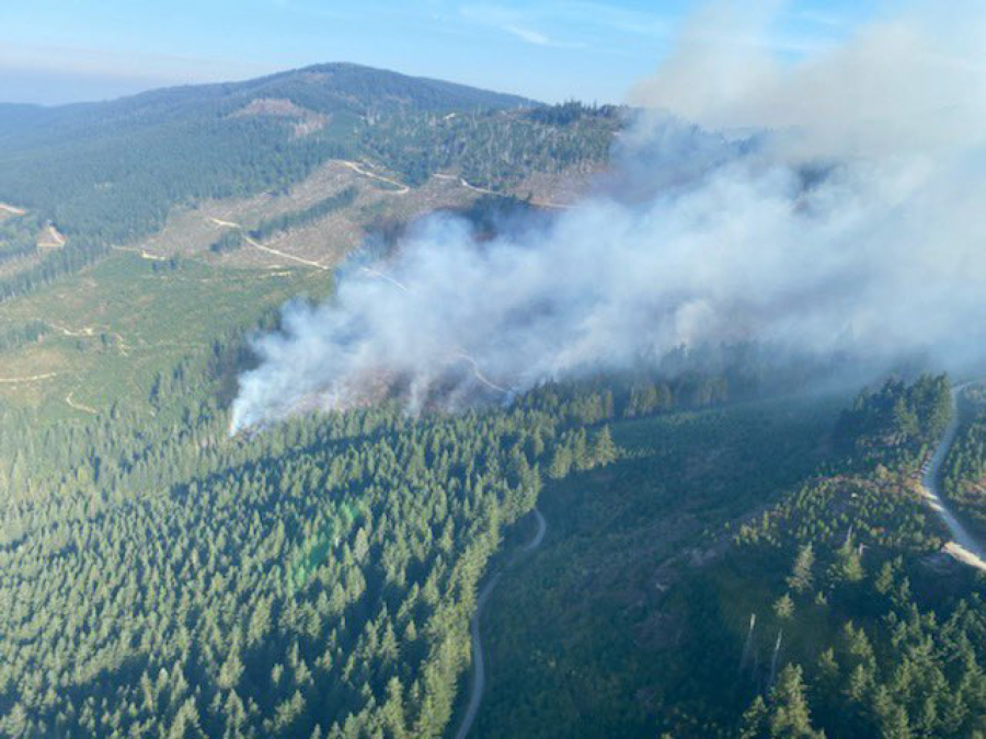
Officials say a wildfire burning in the Larch Mountain area northeast of Camas-Washougal is 20% contained as of Sunday, Oct. 16, but caution that a “red flag” warning for high winds and dry conditions, as well as evacuation warnings for residents in the immediate area, are still in effect as of Sunday morning, Oct. 16. 

Clark Regional Emergency Services Agency (CRESA) reported Sunday morning that “crews plan on shoring up the northwest side of this fire today and continue to make improvements,” but said firefighters need the public’s assistance to ensure everyone’s safety. 

“Please stay out of the closed areas so firefighters can do their job,” CRESA stated on Sunday. “There were a couple close calls yesterday with some (motorcyclists), as well as hunters.” 

All trails within the fire zone are closed to the public, including to hunters. 

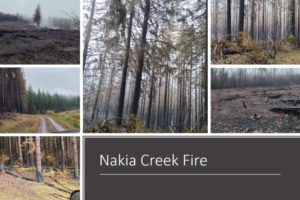
The fire, which officials say is “human-caused” — meaning it was not sparked by lightning — was first reported on Sunday, Oct. 9, in the “Larch Block” of the Yacolt Burn State Forest. Though officials initially said the fire was burning on 250 acres of Washington State Department of Natural Resources (DNR) land, that initial estimate was later lowered to 156 acres. 

Officials sent emergency evacuation warnings to 110 households on Monday, Oct. 10. The majority of the households are in the Level 1 “Be Ready” area. More than a dozen are in the “Be Set” Level 2 zone and, as of Sunday morning, no homes were yet in the Level 3 “Go Now” zone. 

CRESA said Sunday that firelines “held well” on Saturday and that “extreme warm temps, low humidity and high winds (still gusting up to 30 miles per hour in the Larch Mountain area)” caused some “islands of trees … as well as stumps within the fire zone” to send up “some pretty good flames” on Saturday.
“This is actually a good thing,” CRESA reported. “It allows crews to locate these hot spots and helps them burn off additional dangers.” 

At least 90 firefighters were working to contain the fire over the weekend, and CRESA officials said the public should heed the advice of an incident commander on the scene, who told their crews: “While the calendar may say it’s Oct. 16, I need you to think like it’s Aug. 16.”

“With the current weather patterns here in the (Pacific Northwest), we have another good week of potential fire weather,” CRESA officials stated on Sunday. “Please folks, if you are out in the great outdoors, take precautions and be safe. One ‘spark’ could start this entire thing all over again.”

Officials have asked the public to avoid calling 911 or 311 for information about the fire. Instead, to access CRESA’s interactive map of the fire and evacuation notice areas, visit tinyurl.com/2p9emrus. For the most up-to-date information, visit CRESA’s Facebook site at facebook.com/CRESA.911.