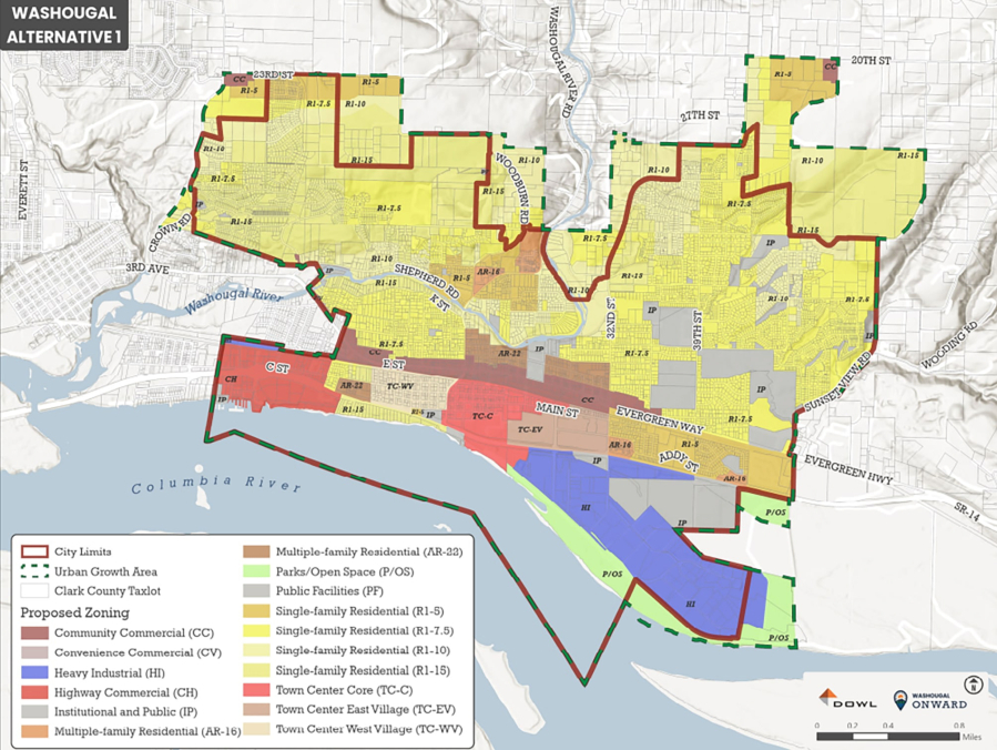
The Washougal City Council has selected a land use map that will play an integral role in the city’s growth over the next 20 years.
On April 14, the council approved the adoption of the “Alternative 1” map, which largely maintains existing zoning throughout the city and assumes development within Washougal’s Town Center district will be 60 percent residential and 40 percent employment.
“This alternative promotes a mix of uses in the Town Center and along the waterfront, with emphasis on housing in these areas,” according to a report by the city’s consultant, DOWL, an engineering firm based in Vancouver.
According to the city’s resolution, the council chose to not expand the city’s adopted Urban Growth Area because the expected jump in population through 2045 can be accommodated within the existing city limits.
“We’re not expanding our boundaries,” Washougal Community Development Director Mitch Kneipp said earlier this year. “We’re not looking to make big, huge land grabs.”