Subscribe

Waterfront plan coming into focus

Port leaders want to finalize Waterfront at Parker’s Landing master plan by year’s end

By
timestamp icon
category icon Latest News, News
Option A has a roadway that follows a trail along the Columbia River; a cove, left in its natural state; and buildings across from the trail designed to create offsets for seating areas in restaurants and shops and provide protection from the elements.

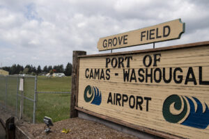
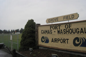
For the past several months the Port of Camas-Washougal has been soliciting feedback from local residents about their preferences for the Port’s waterfront development.

For potential amenities, bars, brewpubs and eateries emerged as the most popular choices. That didn’t surprise Port chief executive officer David Ripp; in fact, he voted for those things as well.

“I like restaurants,” Ripp said. “I want to sit outside. Even if it’s just having a beer or a coffee or an appetizer, I want people to come down for the ambience. There are good restaurants all over, but we want to draw people here with what we call ‘destination purpose.’ That’s what really excites me about this development.”

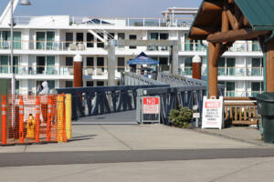
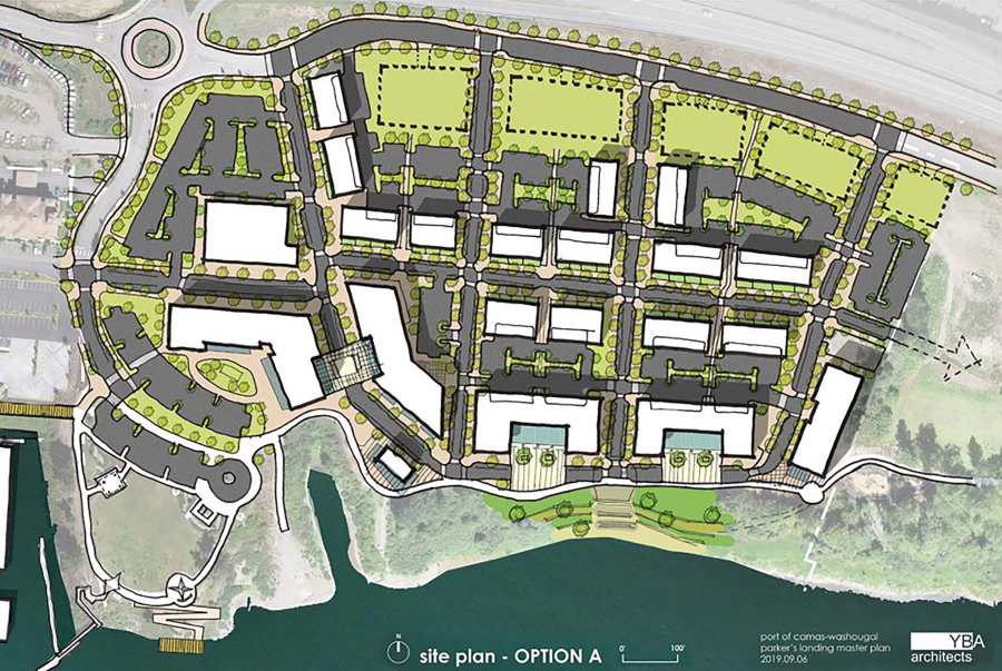
A strong retail base, filled with eating and drinking spots, will be a part of The Waterfront at Parker’s Landing, which Port officials hope will be “a lively, walkable place with community gathering and character spaces, commercial, retail, mixed-use and residential uses,” according to the Port’s website.

At the Port commissioners’ Sept. 15 meeting, Matt Brown of YBA Architects, a Portland-based firm that is working on the project along with Portland-based RKm Development, presented three master-plan options, which were created with the help of the community’s feedback.

However, Port officials aren’t interested in choosing one of the options, which have been posted on the Port’s website and social media channels.

“We do not want to pick the best one,” Port commissioner Larry Keister said at the Sept. 15 meeting. “We want to encourage the discussion of, what part of each one do (local residents) like and what concepts would they like to see put together? This is the beginning of the development of our ideas so that we can start putting things together to make things possible. This is the (public’s) project, and there will be many opportunities for us to continue on with this discussion. We want to put together the best package we possibly can.”

That means the Port is likely to pull together a fourth waterfront option that represents a mixture of elements from the three designs.

“We’ll start talking about that in more depth and detail and take more input from the public at our (upcoming) workshop and meetings, and eventually narrow it down,” Ripp said. “We have to push. We want to keep moving forward. We don’t want to delay, because the more we delay, future events are delayed moving forward.”

He added the Port leaders intend to bring a master concept plan to the commissioners’ Dec. 16 meeting.

All of the three waterfront design options presented earlier this month feature a generalized layout that Brown referred to as a “three-layer cake.”

The first layer features a business core near the waterfront; the second layer houses residential and office spaces; and the third layer, along Highway 14, is filled with commercial and/or industrial facilities.

“Along the waterfront edge is an obvious opportunity to create a retail experience focus zone,” Brown said. “The middle zone — I call it quiet or leafy — has pedestrianized streets, not quite as much foot traffic, (and) we can also blend in a lot of parking. In the third layer, we could look at creating some flexible, larger parcels that you could subdivide or (designate for) larger uses.”

Option A has a roadway that follows a trail along the Columbia River; a cove, left in its natural state; and buildings across from the trail designed to create offsets for seating areas in restaurants and shops and provide protection from the elements.

Option B features a grid-like layout; a public market hall; a boardwalk that allows for pedestrian connectivity along the waterfront; a cove that allows for amphitheater seating with the potential for a small, floating stage; and a roadway between buildings and the trail east of the cove designed for slow vehicular traffic.

Option C has a roadway set back to allow buildings with restaurants and shops to sit adjacent to the trail; a street that acts as an interior connector and secondary “main street;” a cove that allows for a potential pedestrian bridge; and a riverbank with the potential for a floating stage.

Brown said he’s excited to be part of a “huge opportunity” to develop the land.

“This is one of the most unique sites anywhere in the world, let alone the Northwest, and one of the prime remaining development sites on the Columbia River,” he said. “We’ve come at this with the approach from the beginning that the most important thing we can do is help the community better connect with this amenity, with the views, marina activities, the walking activities, the boating and also with the economic development opportunities that are here and inherent to such a prime site.”

Port officials and commissioners will discuss the project at the commissioners’ Oct. 15 workshop and Oct. 22 meeting. The first-phase preliminary master concept plan is set to be approved Nov. 4, and the first-phase final master concept plan is scheduled to be approved Dec. 16.

Ripp said he would like to see construction begin in 2021.

“There’s a light at the end of the tunnel,” Ripp said. “Doing this first phase of the process — getting a master plan, figuring out what phase one is going to be — is exciting, but for me the home run, the coup de grace, will be when we’re sticking a shovel in the ground. You can plan and do what you want all day long, and I’m fine with that, and I like doing that, but let’s get some dirt moving and some building going.”