Camas-Washougal logo tag

Wander through wondrous spring wildflowers at sites throughout Columbia River Gorge

Mild winter brings out blooms earlier

By
timestamp icon
category icon Clark County, Life, Outdoors

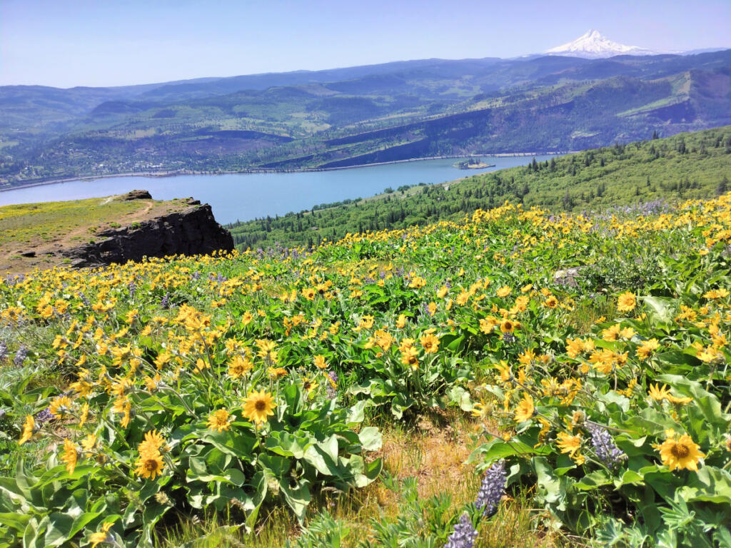
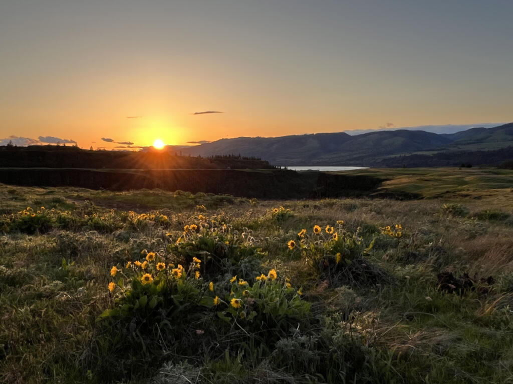
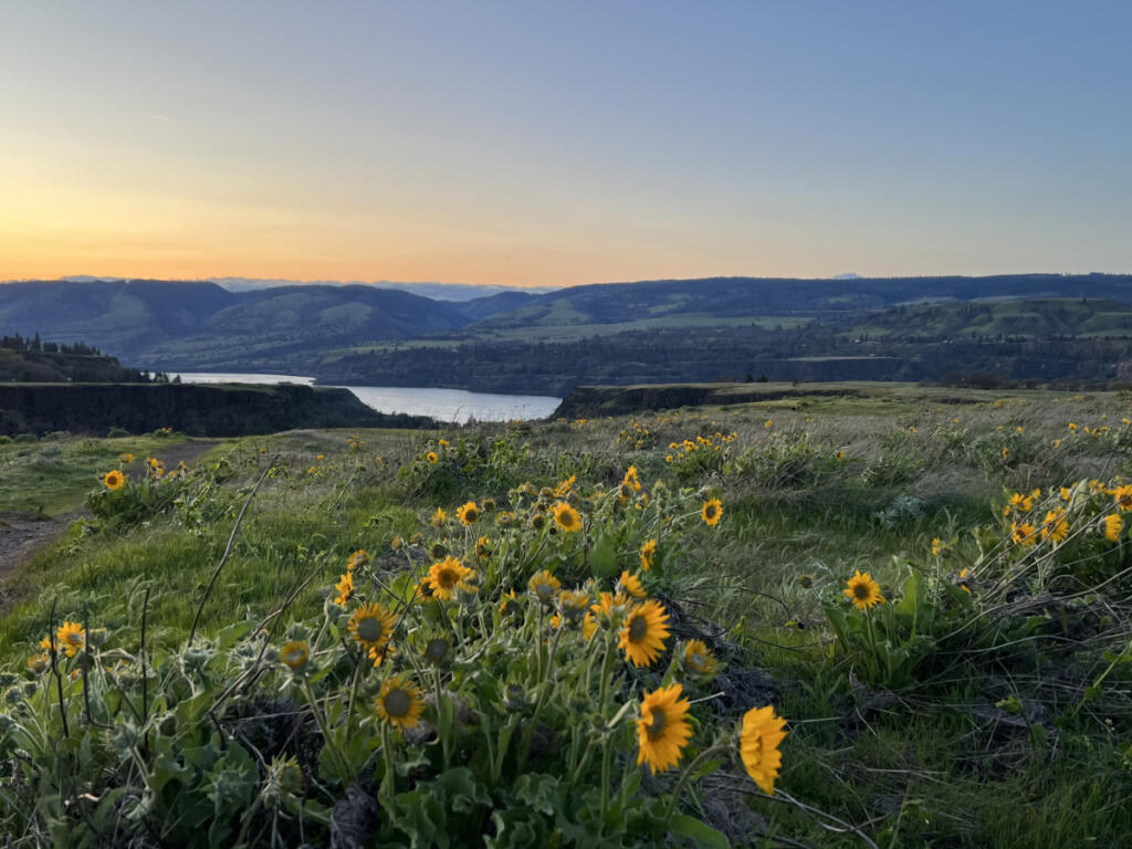
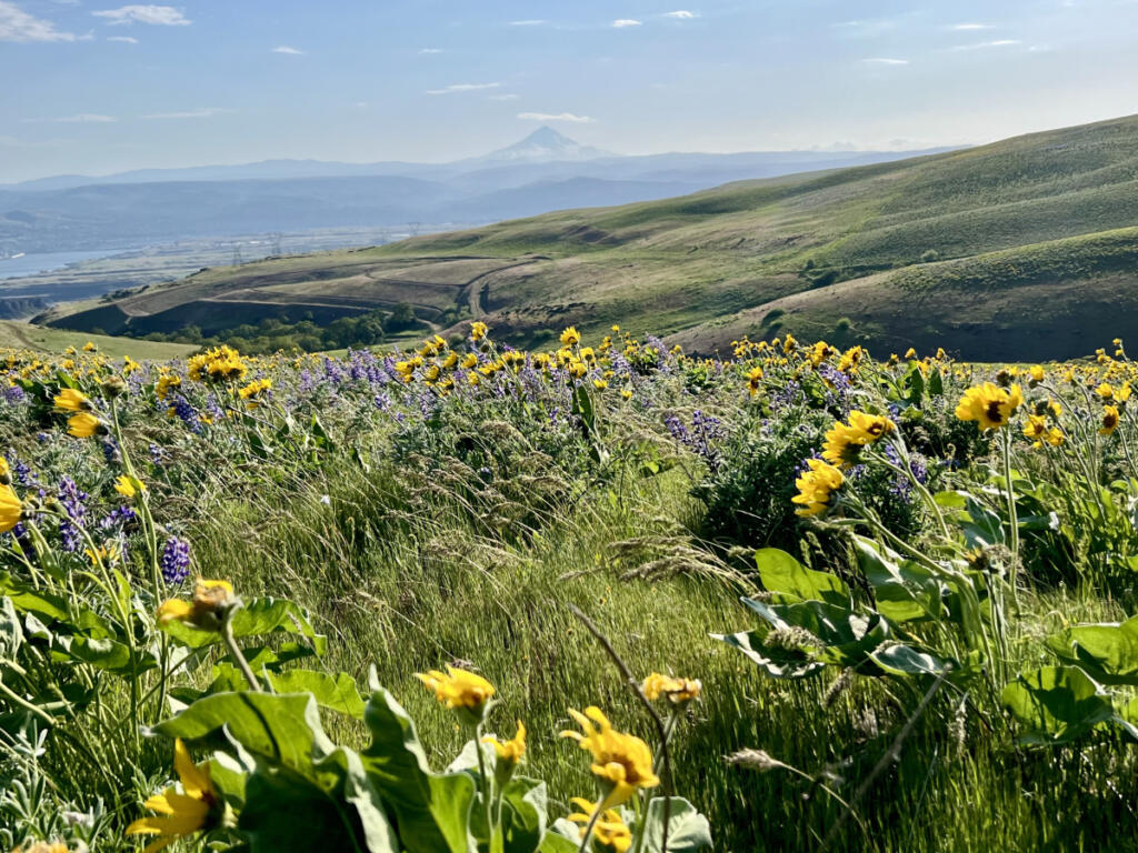
Even while worrying about a warming planet, here’s a reason to revel in early spring: gorgeous wildflowers in abundance.

“Due to our mild winter weather conditions, blooms have begun a bit earlier than last year,” said Beth Kennedy, U.S. Forest Service spokesperson for the Columbia River Gorge National Scenic Area, who’s based in Hood River, Ore.

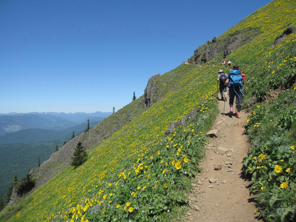
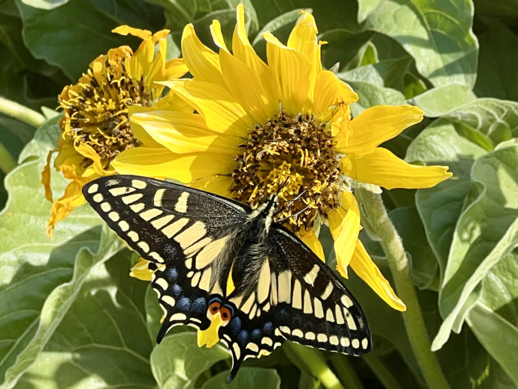
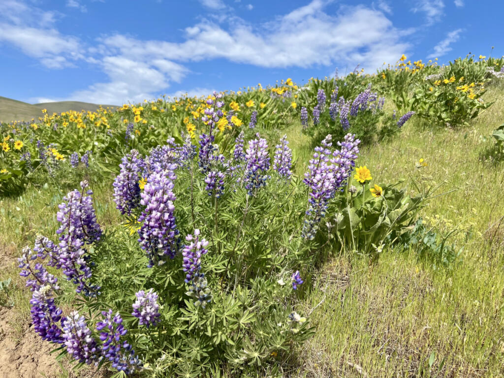
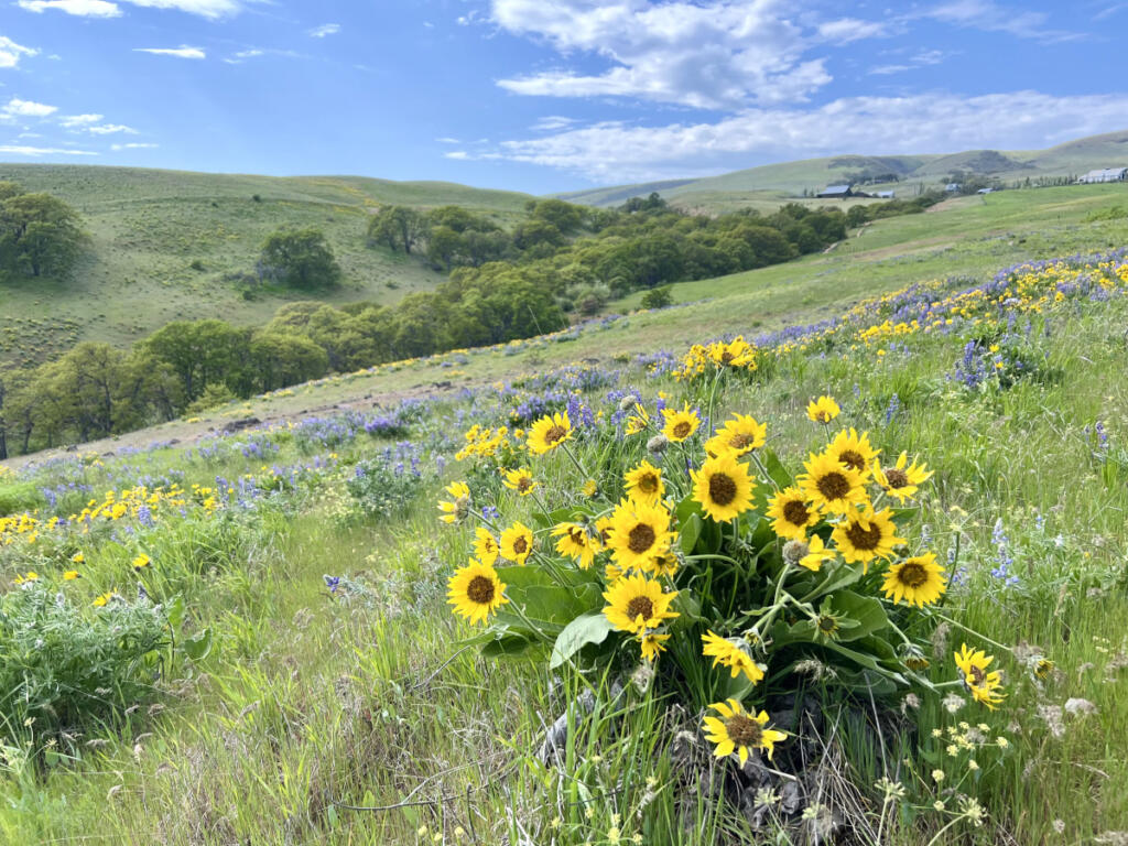
Go east from Clark County to get lost in carpets of color that grow so intense, it’s hard to believe they’re entirely natural and not super-saturated by computer animation wizards at Pixar.

Nope: the Columbia River Gorge National Scenic Area contains no artificial colors or sweeteners. The only artificial preservatives are rules and laws that manage growth and development in this special region — which is serious business, considering how popular the Gorge has become both with tourists and with townies who don’t return to Portland or Vancouver after their day trip. Municipalities in the Gorge have been growing steadily in recent years, and there’s no end in sight.

It’s a complicated economic picture, as The Columbian reported recently: While spending on food, drink and overnight accommodations by penny-pinching tourists is down in Skamania County, those visitors still day trip the Gorge in droves to fish and hike.

So consider making your wildflower wanders on weekdays if all possible. On spring and summer weekends, you might find the Gorge overflowing with traffic and sightseers — just like you.

In fact, one of the Gorge’s maximum wildflower sites is also one where, without careful advance planning, you might just get crowded out. That’s Dog Mountain, beloved for its profusion of high-altitude blooms and infamous for the thigh-busting switchback challenge it takes to get all the way up there. The Dog Mountain hike is seven miles round-trip, with an elevation gain of 2,828 feet — and if you go, you’ll be joining everyone from huffing-and-puffing walkers with poles to obviously insane trail runners who somehow take the steep journey at a gallop.

Fitness may be their goal, but yours can be the incredible spread of gleaming yellow arrowleaf balsamroot (the Gorge’s resident sunflower), long-stemmed purple lupine, red paintbrush and yellow desert parsley up near the top.

Because spring wildflower peepers used to overrun the Dog Mountain parking lot and wind up parking and walking on the narrow highway — which is illegal and dangerous — in 2018 the Forest Service instituted a peak-season weekend parking permit system there.

Thanks to this year’s early blooms, the Dog Mountain mandatory parking permit requirement has shifted a little earlier too: April 11 through June 7. Permits are technically free, except for a $2 administrative fee for each. In addition to this single-day parking permit (which does not guarantee a parking space, the Forest Service is careful to point out), you also need a standard $5 day-use visitor permit, which can also be purchased online, or at a machine at the trailhead.

Get the latest headlines in your email every week!

This field is for validation purposes and should be left unchanged.

(As an alternate to all that, starting April 11, dedicated transit fans can try parking at the Skamania Fairgrounds in Stevenson and riding the free Dog Mountain shuttle, which runs every half hour from 7:30 to 5 p.m. on weekends and Memorial Day. Ride the shuttle and your Dog Mountain day-use hiking permit is free. Learn more about the shuttle at ridecatbus.org/dog-mountain-shuttle.)

After all that permitting, it’s still possible that you’ll find the Dog Mountain trail pretty packed on spring and summer weekends. There is a trailhead bathroom. There’s also an iconic reality-checking sign where the trail forks: This way, “Difficult.” That way, “More difficult.” The sign is funny, but it’s not joking. We advise sticking with simply “Difficult.”

Go east

Have you ever ventured way out east in the Gorge? Some longtime locals never do, taking for granted that “Columbia Gorge” means the nearby, evergreen zone that contains Beacon Rock and Multnomah Falls and ends with the Bonneville Dam. Our advice is to proceed past all that and also past Hood River, which is where forests give way to an entirely different landscape: wide-open grasslands, golden canyons, lots of sunlight, immense vistas — and, in spring and early summer, masses of eye-popping wildflowers.

Here’s a guide to those sites, which we’ve arranged east to west — starting at the far end of the Gorge and moving back toward familiar territory. Almost all are on the Washington side. (This writer’s usual strategy is a morning sprint to the far end of the Gorge, for an early arrival and a whole day to wander. Another approach is to arrive later and make it an afternoon hike, with the possibility of taking in the golden rays of sunset. Either way, cap off your journey with dinner in Bingen or The Dalles.)

Authoritative resources for up-to-the-moment flower sightings are NWWildflowers.com and OregonWildflowers.org (which includes Southwest Washington). Another great hiker report resource is the Washington Trails Association site. A comprehensive site for browsing potential Gorge hikes is the Friends of the Columbia Gorge “Find a Hike” page.

Always bring water, food, appropriate clothing and your cellphone. Rattlesnakes do slither about in the eastern Gorge, but encounters are rare.

  • Columbia Hills State Park (95 miles east of Vancouver) is vast (3,338 acres) and gently rolling. There are several different entrances to the park, but here’s a tip: Skip the roadside Crawford Oaks trailhead, which requires dragging yourself about a mile up a disappointingly nonscenic dirt road before you reach the good stuff. Instead, opt for the Horsethief Butte trailhead (for a short riverside hike and perhaps a quick climb inside the butte) or the upper trailhead that requires driving a few miles up unpaved but well-maintained Dalles Mountain Ranch Road. From that upper trailhead, Columbia Hills offers incredible views and two huge hiking loops in a figure-eight, totaling about eight miles. (You don’t have to do both loops.)

There’s an even remoter, higher-up hiking area above Columbia Hills called Stacker Butte. Driving up there can get rough, but take it slowly and you’ll make it to the tiny parking lot. Walking up the winding gravel road from there takes you to the scenic top of the Columbia Hills ridge, where weather stations and telecommunications towers share the space with carpets of golden balsamroot and purple lupine that seem just about endless.

According to OregonWildflowers.org, the site also features local rarities including the Dalles Mountain buttercup (with five bright yellow egg-like blooms) and the hotrock penstemon (white, pale or yellow flowers with purple lines).

Difficulty: Easy to moderate. Bathrooms: yes. State park day use fee: $10 (or $45 for a year).

  • Lyle Cherry Orchard (80 miles east). The newest addition to the Gorge’s menu of trails is this 540-acre Friends of the Columbia Gorge preserve, adjacent to the town of Lyle. The steep trail offers periodic rest stops on spectacular shelves of land that offer stunning views of the Gorge. (There’s no cherry orchard here— that’s a historical name.) The trailhead is unmarked and the parking lot easy to miss, but it’s one mile east of downtown Lyle, just after you emerge from Tunnel no. 7.

Difficulty: moderate. Bathrooms: no. Fee: no.

  • Rowena Crest (78 miles east): On the Oregon side of the Gorge, a few miles beyond Hood River, is a pair of flowery sites, one steep and strenuous, the other mostly flat. Exit the freeway at Mosier, proceed another few miles to roadside parking at scenic Rowena Crest, and take your pick of Rowena Plateau, a rocky walk that takes you to riverside cliffs, or McCall Point, which zigzags up a flowery hillside (3 miles round trip) to an ideal picnic spot.

Difficulty: moderate. Bathrooms: no. Fee: no.

  • Klickitat Canyon State Park and Balfour-Klickitat Loop (76 miles east). Two easy yet contrasting wildflower sites, conveniently located on opposite sides of the mouth of the Klickitat River, just off state Route 14. Both are perfect for folks who need pathways with pavement. East of the river is the state park trail, a converted railway whose first 1.5 miles are paved. It continues for many miles of packed gravel to the north and east, and cyclists love exploring the combination of forest rangeland and wilderness. (Watch out for cows on the trail.) West of the river is the paved Balfour-Klickitat Loop, a short (0.7 mile) trail overlooking a pretty cove, featuring tons of bird life as well as flowers galore.

Difficulty: easy. Bathrooms: at the state park trailhead only. Fee: $10 for the state park, no fee for the Balfour loop.

  • Catherine Creek (75 miles east): Perhaps the most beloved wildflower site in the Gorge because of its bewildering variety and relative hiking ease. “In the soil among the lava rock are mini botanical gardens,” says a Mt. Adams Chamber of Commerce brochure. “New species appear with each bend of the trail.” The main Catherine Creek hike offers numerous small and large hiking loops. (It usually also offers an iconic natural stone arch, but that area remains closed after last year’s Burdoin Fire. All hiking trails are open.) Across the highway, closer to the river, is a paved, universal-access loop that’s just a quarter-mile long. Perfect for flower lovers using mobility devices.

Difficulty: Easy to moderate. Bathrooms: one port-a-john. Fee: no.

  • Coyote Wall: (72 miles east): A labyrinth of trails crisscrossing a huge, furrowed plateau. Ambitious hikers can venture east from Coyote Wall over to Catherine Creek and back. Hardy hikers can stay west and trace the steep edge of the basalt bluff. Coyote Wall was scorched by the Burdoin Fire last year, but it’s open and thriving now.

“The wildflowers at both Coyote Wall and Catherine Creek are blooming beautifully this year!” Kennedy said by email. “Plants in these dryer, eastside ecosystems have evolved and become adapted to wildfire.”

Difficulty: moderate. Bathroom: yes. Fee: no.

  • Great Camas Patch (48 miles east): An obscure flower patch that isn’t so far east in the Gorge. According to Friends of the Columbia Gorge, the distinctly underappreciated spot is tucked between Wind River Highway and state Route 14, and reachable via dead-end Carson Depot Road. Walk a very short trail to reach purple camas flowers that bloom in abundance in spring.

Difficulty: easy. Bathrooms: no. Fee: no.